


Land Lots
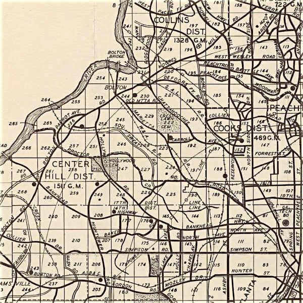
The land lots and names below are in District 17, Fulton County,
from an FCG Map (below) from 1872 by Daniel Pittman.
193 - Bellingrath
193 - Burge
194 - Hatcher
195 - Campbell
195 - Hatcher
195 - Moore
196 - Moore T.
197 - Howell
198 - Howell
218 - Howell
219 - Howell
219 - Callahan
219 - Lyon
220 - Moore
221 - Moore T.
222 - Burge
222 - Casey
222 - Crestlawn Cemetery
223 - Durning
223 - Golden
226 - Donehoo
227 - Donehoo
228 - Casey’s District
229 - Mauldin B. F.
230 - DeFoor M.
230 - Maudlin
231 - DeFoor
232 - Howell
232 - Lyon
233 - Howell
234 - Howell
240 - Howell
241 - Howell
242 - DeFoor Ferry
243 - Iceville
244 - DeFoor M.
246 - Donches
246 - Donehoo
247 - Donehoo
247 - Hollywood Cemetery
250 - Hollywood Cemetery
250 - Hulsey
251 - Donehoo
252 - McGriff B. L.
255 - McGriff E. L.
256 - Dobbs
256 - Montgomery
256 - Ga. Western Railroad
257 - McGriff E. L.
258 - Heil
260 - Mayson
261 - Mayson
261 - Mayson Church Academy
261 - Moody A.
262 - Hooper
262 - Hooper’s Mill
263 - Dobbs
263 - Montgomery
265 - Harper
266 - Mayson
266 - Turner’s Ferry
267 - Mayson
268 - Hooper
The State of Georgia, in preparation for the 1821 Georgia Land Lottery, to dispense lands acquired from the Indians, divided the land that is now Fulton and DeKalb Counties. Fulton was created in 1853 out of DeKalb County, and DeKalb out of Henry County. Included in the Upper West Side are the 17th and 14th Districts. There is land lots numbered sequentially within each district. Each land lot was approximately 202.5 acres. Land lots are still used today and have not changed since 1821. The Militia Districts were used for militia organization, and as minor civil divisions for organizing tax rolls, censuses, and for use as voting districts. The size was originally determined by the number of eligible men in each area. This area made up the 469th Georgia Militia District.

The land lots and names below are in Disrict 14, Fulton County, from an FCG Map from 1872 by Daniel Pittman.
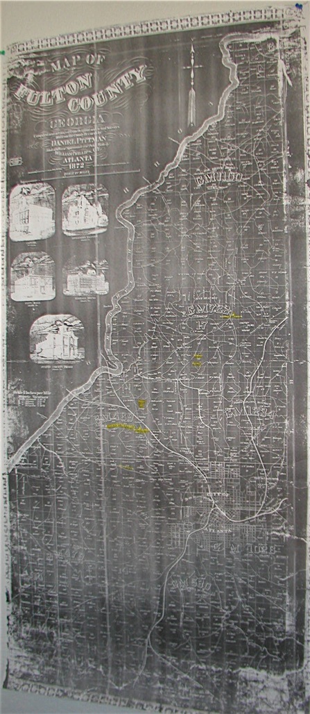
1942 Fulton Co. Land Lot Map
Fulton County,
FCG Map (below) from 1872 by Daniel Pittman.
It is difficult to transcribe the map below, we do believe that the names above in district 14 are not correct.
We will correct them soon.