


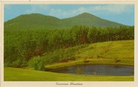
Kennesaw Mountain
In the short 1.2 mile hike
up the mountain,
708 ft. is gained, making the elevation 1808 ft. above sea level.
Kennesaw Mountain National Battlefield Park
CULTURAL OVERVIEW
By Robert Hellman (2003)
Southeast Chronicles Home
NATIVE AMERICAN ARCHEOLOGY AND CULTURE HISTORY
Located just east of the Great Smoky or Cartersville Fault line that forms the boundary between the Upper Piedmont and the Ridge and Valley Province of northern Georgia, Kennesaw Mountain National Battlefield Park lies approximately midway between the Chattahoochee and Etowah Rivers, the two major rivers that drain this portion of the state (Hally and Rudolph 1986:2). Years of archeological study in the Etowah River drainage to the northwest, particularly in conjunction with the development of Allatoona Lake, has allowed the definition of a well documented sequence of cultural phases for this section of the state. The cultural sequence for the upper Chattahoochee River area to the west of KEMO is much less well known, although it can be assumed to follow in many ways the general cultural sequences of northwest Georgia, including Allatoona Reservoir. A general overview of these cultural developments with particular reference to nearby sites that can be assumed to reflect to a greater or lesser degree those archeological resources that can be expected to occur within the park is the focus of the following chapter.
PALEOINDIAN PERIOD
Exactly when humans first arrived in the New World is a question of current debate in American archeology. Until a few years ago, the most popular view was that the first peoples migrated from Asia across the Bearing Strait land bridge during the last Ice Age approximately 12,000 years ago and quickly spread to the rest of North and South America. But recent discoveries at archeological sites in South America found to date 12,500 and more years ago (Adovasio and Pedler 1997; Meltzer et al. 1997; Bonnichsen 1999) and questions regarding the accuracy of early Holocene radiocarbon dates (Fiedel 1999; Taylor et al. 1999) have now caused the archeological community to reconsider the timing, the routes and the means by which the first Americans arrived and populated the two continents.
The earliest known peoples to leave an indisputable archeological record in the Georgia Piedmont are referred to as Paleoindians. The Paleoindian period (ca. 9500-8000 B.C.) is characterized as a time when small nomadic bands of Indians subsisted on the gathering of wild plant foods and the hunting of Pleistocene fauna, which included migratory herd species such as caribou, giant bison, mammoths and mastodons. To what extent Paleoindian peoples subsisted on the now extinct "megafauna" in the Southeast is uncertain, but the changing environment and animal extinctions also coincided with changes in the material culture of Paleoindians, particularly projectile point forms. In most cases, it is the presence of large, distinctive, lanceolate projectile points that provide the only clear evidence of Paleoindian activity in an area, with changing styles of lanceolate points used to separate the Paleoindian period into three subperiods, or phases; Early (ca. 9,500-9,000 B.C.), Middle (ca. 9,000-8,500 B.C.), and Late (ca. 8,500-7,900 B.C.) (Anderson et al. 1990:7-8).
Early Paleoindian sites in the Southeast are generally indicated by the presence of fluted Clovis points, which have been identified in the Georgia Piedmont during archeological surveys conducted near the Allatoona Reservoir and the Laffingal Tract along the Etowah River (Anderson et al. 1990:17)). Evidence indicates that Paleoindians of this period relied on a shifting settlement pattern and collecting strategy which consisted of family groups that set up central base camps from which they made periodic trips out to short-term extraction camps to collect resources and hunt until the resources of a certain area became exhausted, at which point the band relocated (Anderson et al. 1990:5).
The Middle Paleoindian period, dating from ca. 9,000 to 8,500 B.C., is marked by the appearance of a wider variety of projectile points throughout the Southeast which have been referred to as Cumberland, Suwanee, and "Clovis Variants" (Anderson et al. 1990:6) (Image 1). The appearance of a variety of projectile point styles during this period is thought to indicate the establishment of somewhat less nomadic populations and the development of regional cultural variants (Anderson et al. 1990:9) that coincided with the environmental transition from the "patchy boreal forest" conditions of the late Pleistocene to the "homogenous, mesic oak-hickory forest" that arose in the Piedmont by the beginning of the Holocene (Anderson et al. 1990:3).
By the Late Paleoindian period, ca 8,500 to 8,000 years B.C., the transition to oak-hickory forest was complete and many of the various species of Pleistocene fauna that had inhabited the now vanished boreal forests had been replaced by modern species. Paleoindian peoples responded by adapted a "foraging" strategy that included frequent basecamp movements. Point types associated with this time period include Dalton, Quad and Beaver Lake (Anderson et al. 1990:8). Dalton points have been radiocarbon dated to roughly 8500-7900 B.C. (Goodyear 1982; Justice 1987:40), transcending the 8000 B.C. date commonly used as the chronological boundary separating the Paleoindian from the succeeding Archaic period. Given the vagaries of radiometric dating methods, Dalton points are assumed, for the purposes of this summary, to date to the Late Paleoindian period (8500-8000 B.C.).
To date, no Paleoindian artifacts/sites have been identified in Kennesaw Mountain National Battlefield Park, but, like the Early Paleoindian, a number of Middle and Late Paleoindian sites have also been identified nearby within the west Georgia Piedmont during the Lake Allatoona and Laffingal Tract surveys (Anderson et al. 1990:20-21). The presence of Middle and Late Paleoindian sites in the region is also demonstrated within private collections which contain a large number of various Paleoindian points. Based on the numbers and distributions of Paleoindian points recovered in Georgia, Anderson, Ledbetter, and O'Steen (1990:21) have concluded that upland areas were more heavily utilized during the Middle and Late Periods based on the presence of Clovis Variants, Dalton, and Greenbrier-like points, while Early Paleoindian Clovis-like points are more generally associated with lower elevations. Overall though, the Piedmont area does not appear to have been heavily utilized throughout the Paleoindian period. Other surveys indicate that Paleoindian occupation of the west Georgia Piedmont along the Chattahoochee River was also limited (Anderson et al. 1990:22).
ARCHAIC PERIOD
Like the Paleoindian period, the succeeding Archaic period in west Georgia is not as well known as the later Woodland and Mississippian periods that follow. In part, this is attributed to the fact that very few of the numerous Archaic period sites identified in northwest Georgia have been studied extensively, particularly "well stratified sites" with their correspondingly telling sequences of artifact collections (DePratter 1975:13; Ledbetter et al. 1990:271). Study of this early period in northwest Georgia prehistory is also complicated by the fact that throughout most of the Archaic period, populations remained relatively small and mobile, moving frequently to hunt and gather seasonally available wild animal and plant foods, making the identification of short-lived house structures or living areas from this time period difficult in many cases. Furthermore, the identification of Archaic sites in most cases continues to be based primarily on the presence of particular projectile point types, often without the benefit of obtaining corroborating radiocarbon dates. Despite these shortcomings, the Archaic period in northeast Georgia and the Chattahoochee River drainage is by no means unknown.
The onset of the Archaic period is accompanied by a distinct change in projectile point styles from the large lanceolate points of the Paleoindian period to somewhat smaller, triangular shaped points exhibiting corner or side notching (DePratter 1975:2). As Archaic peoples became more populous and less transient with the passage of time, projectile point forms continued to evolve and proliferate in both numbers and styles. Like the preceding period, the Archaic is divided into three sub-periods Early (8000-6000 B.C.), Middle (6000-3000 B.C.), and Late Archaic (3000-1000 B.C.).
Analysis of site records from southeastern states by Anderson (1996a:157) indicates that Archaic sites, while generally increasing through time, decrease slightly between the Early and Middle Archaic periods before increasing after the Middle period. Only Georgia and the Carolinas apparently experience an increase in sites between the Early and Middle Archaic (Anderson 1996a:158). In the Georgia Piedmont, Early Archaic sites tend to be concentrated near river systems, such as the upper Chattahoochee, which lies east and south-east of KEMO (Anderson 1996a:160-161).
Early Archaic (ca. 8000-6000 B.C.)
The Early Archaic in the Georgia Piedmont is typically interpreted as a period during which: 1) the environment changed from a mixed conifer-northern hardwood forest to a closed canopy, mixed hardwood forest habitat, 2) the population was relatively low, perhaps 50 to 150 people per band, and 3) the hunting territories were smaller than previous Paleoindian territories but still relatively extensive, providing access to a wide array of environmental settings and seasonally available subsistence resources (Delcourt and Delcourt 1981; Anderson and Hanson 1988; Daniel 1996; Anderson and Sassaman 1996). These changes formed the basis for the development of regionalized patterns in subsistence modes, resource utilization, and artifact manufacture.
In the Georgia Piedmont, point types generally considered Early Archaic or transitional Paleoindian/Early Archaic include Hardaway Side Notched, Kirk Corner Notched and Big Sandy/Taylor (Justice 1995:41; Ledbetter et al. 1996). The Big Sandy/Taylor horizon has been found to overlap somewhat in time with the late Dalton horizon which, along with some similar traits between the two projectile point types, suggests a cultural continuity (Futato 1996:310; DePratter 1975:2). Big Sandy/Taylor points, however, are distributed over a larger geographic area than Daltons, suggesting an increase in population and a wider utilization of different environments (Walthall 1980:50-52).
Hardaway Side Notched projectile points, found throughout the Southeast, are also believed to be of a form transitional to the later more distinctive side notched points of the early Archaic period (Justice 1995:43). Kirk Corner Notched, and their morphological relatives (e.g., Palmer Corner Notched, Decatur, Lost Lake, and Plevna), are perhaps the most distinctive of the early Archaic points found in the Southeast. These are medium-sized, corner-notched forms that typically exhibit deep serrations and beveling on the blade edges. Kirk Corner Notched points appear to have diffused over much of the Eastern Woodlands including northwest Georgia from about 7400 to 6500 B.C. (Chapman 1976; Walthall 1980).
Sometime around 7000 B.C., a number of new point styles exhibiting basally notched or "bifurcate" stems appeared in the Georgia Piedmont. These include the types MacCorkle (ca. 7000-5800 B.C.), St. Albans (ca. 6900-6500 B.C.), Kanawha and LeCroy Stemmed (ca. 6500-5800 B.C.) (Chapman 1985; Justice 1987; Anderson and Joseph 1988:110). Toward the latter end of the Early Archaic the introduction of points known as Kirk Stemmed/Serrated (ca. 6300-6000 B.C.), represents another shift in projectile point styles toward stemmed forms, such as Stanly (ca. 5800-5500 B.C.), and White Springs/Sykes/Benton-like projectile points (ca. 6000-3500 B.C.), that would largely characterize the following Archaic substage, in northern Georgia, the Middle Archaic. The appearance of Kirk Stemmed points at the very end of the Early Archaic, in addition to signaling the advent of new point styles, may also be accompanied by a shift in settlement patterns from one hypothesized to involve establishment of longer-term base camps in riverine settings from late fall-to-winter and shorter-term foraging camps in upland settings the rest of the year during the Early Archaic (Anderson 1996c:41) to a nearly continuous use of all topographic settings through a series of temporary encampments during the Middle Archaic, a pattern that has been characterized as fluctuating somewhere between short-term specialized extractive sites and longer-term base camps (Coe 1964; House and Ballenger 1976; Elliot 1987).
The Vulcan site located in the Etowah River valley near Cartersville, Georgia, is perhaps indicative of this shift. Less than 20 meters in diameter, the Vulcan site represents a small, unplowed, lithic scatter that also retained evidence of a rock hearth, small smudge pits, and a roughly 6 meter by 6 meter probably tent-like structure (Ledbetter 1992; Ledbetter et al. 1996:276-277) in an upland ridge setting. The recovery of Kirk Stemmed points at the site firmly places it at the end of the Late Archaic in terms of temporal placement, but the technological and subsistence patterns seem to reflect those patterns more typical of the ensuing Middle Archaic.
Middle Archaic (ca. 6000-3000 B.C.)
Corresponding roughly in time with a warmer and drier climatic period known as the Hypsithermal (6000-3000 B.C.) during which the predominant mixed hardwoods forests of the Georgia Piedmont were replaced by essentially modern oak-hickory-southern pine forests (Delcourt and Delcourt 1981), the Middle Archaic stage is generally viewed by most archeologists as a period of increased cultural regionalization resulting from growing populations and shrinking territorial boundaries. Ground stone implements including atlatl (spearthrower) weights and axes appear for the first time during this period as do a number of plant processing tools-nutting stones and manos. These, along with the occurrence of storage pits and large quantities of fire-crack rock at some sites suggests there was a greater degree of sedentism compared to the previous Early Archaic period, but frequent movements in search of wild game and plants was still a way of life which have left behind an array of Middle Archaic sites in virtually every environmental setting, most notably on knolls and ridge crests in upland setting, a pattern that have been characterized as fluctuating somewhere between short-term specialized extractive sites and longer-term base camps (House and Ballenger 1976; Ledbetter et al. 1987; Webb and Gantt 1997:17; Prentice 2001). As a result of lowered residential mobility and smaller territories, there was a greater reliance on locally available raw materials in the manufacture of stone tools, a pattern that is reflected in the Georgia Piedmont where chert is rare (DePratter 1975:13) by increased use of crystal quartz and quartzite (more precisely, orthoquartzite) in the manufacture of projectile points and other tools. It was the extensive use of quartzitic materials for lithic tool manufacture during this period that led Caldwell (1958) to propose the term "Old Quartz Culture" for sites of this general time period (Johnson 1981:57). Since then, many of these point forms have been identified as local varieties of Morrow Mountain (ca. 5500-3500 B.C.), Guilford Lanceolate (ca. 4500-3500 B.C.), and Savannah River Stemmed (ca. 4500-3500 B.C.), the last of these now considered a hallmark of the Late Archaic period in northern Georgia (Justice 1995:105; Steen and Braley 1994:21; Anderson and Joseph 1988).
Late Archaic (ca. 3000-1000 B.C.)
The Late Archaic (ca. 3000-1000 B.C.) was a period of major demographic, technological and economic change for Georgia's native peoples. The shear number of archeological sites compared to earlier periods increases greatly throughout the Southeast during the Late Archaic, which many archeologists (e.g., Anderson 1996a:165; Ledbetter 1992:12; Webb and Gantt 1997) conclude is evidence of significant population increases, greater sedentism, as well as "moderate to extensive use of almost every part of the region" (Anderson 1996:165). Also, by the end of this two thousand year span, Late Archaic peoples over much of the Southeast had, to some extent, adopted the use of pottery, participated in long distance exchange networks to obtain non-local resources, and begun experimenting with plant husbandry. The earliest planted crops included squashes, gourds, sunflower, sumpweed, and chenopod (Crites 1991; Smith 1989; Gremillion 1993). Currently, there is no direct evidence to support the proposition that Late Archaic peoples in the Kennesaw Mountain area were horticulturalists; but there is good evidence that peoples in the Little Tennessee River valley in nearby eastern Tennessee were planting gardens using native plant species (Chapman and Shea 1981; Gremillion 1993; Wetmore and Goodyear 1986), and it has been suggested that the widespread adoption of pottery may have been largely associated with the adoption of plant husbandry and the demise in the soapstone vessel trade which flourished in the northern Georgia and western South Carolina region between 2000 and 1000 B.C. (Elliot 1986; Sassaman 1993; Yates 2000).
In the face of all these various innovations, Late Archaic peoples still continued to subsist much like their predecessors, following a seasonal round of hunting and gathering to obtain the bulk of their subsistence with relatively little reliance on cultivation (Crook 1984:54-56, Wood and Ledbetter 1990:143). And like the preceding time periods, projectile point styles remain the usual means of assigning sites to the Late Archaic period, with a variety of stemmed points types such as Savannah River Stemmed (ca. 3500-1000 B.C.), Ledbetter Stemmed (ca. 2500-1000 B.C.), and Flint Creek (ca. 3000-1000 B.C.) (Cambron and Hulse 1975; Justice 1987; Ledbetter 1992:13) being among the most common.
A nearby example of a site containing Savannah River Stemmed points is located just nine miles east of KEMO and approximately half a mile south of Sope Creek on a narrow levee fronting the Chattahoochee River. Here, at the Sibley Lithic Station (9Co42) site, buried cultural deposits were encountered that yielded lithic assemblages dominated by quartz (Meier n.d.:4). Projectile points recovered from Zones III and IV from the site exhibit the great range of variability that can occur within the Savannah River Stemmed point type (Justice 1987:163-166). The unexpectedly early radiocarbon assays (5595+435 B.C. [UGA 482], 3485+135 B.C. [UGA 483], 5740+355 B.C. [UGA 484], uncalibrated) obtained from Zones III and IVa at the Sibley Lithic Station suggests that perhaps some early Savannah River Stemmed points may predate the ca. 3500-1000 B.C. date range generally accepted for this point type (Oliver 1981:159; Justice 1987:163; Anderson and Joseph 1988:151).
Another similarly situated, roughly contemporaneous site situated nearby is available at the Cagle (9Ck23) site located just outside Canton, Georgia, approximately 20 miles due north of KEMO. This site, which is also identified as a lithic workshop (and residential area), is similarly situated on a natural levee within the floodplain of the Etowah River near the mouth of Hickory Log Creek (Crook 1984:1). In this case, the Savannah River Stemmed projectile points recovered within Stratum H at the site were also accompanied by a few Morrow Mountain II points, all of which were manufactured primarily from quartz at the site (Crook 1984: 36, 47, 52). A single radiocarbon date obtained from charred wood fragments taken from Stratum H produced an uncalibrated date (Beta-4351) of 2480+90 B.C. (Crook 1984:36). Carbonized floral remains recovered from Stratum H indicate consumption of hickory nuts, walnuts, acorns and persimmons occurred during the formation of this evidently transitional Middle to Late Archaic deposit.
The "transition" from Late Archaic to Early Woodland is also purportedly represented at the Cagle site from midden deposits ("Stratum D") wherein Savannah River Stemmed projectile points and Early Woodland ceramics (Dunlap Fabric Marked, Mossy Oak Simple Stamped, Cartersville Check Stamped, and sand-tempered plain) were recovered together within a midden deposit associated with a number of pit features and postmolds (Crook 1984:52). An uncalibrated radiocarbon determination of 600+60 B.C. (Beta-4352) made on charcoal fragments from the Stratum D midden conforms in age with the generally accepted date of introduction for these ceramic types as somewhere in the neighborhood of 1000 to 600 B.C. (Anderson 1996b:207-209), but appears to be too late for the Savannah River Stemmed points, which are more likely to have been derived from a somewhat older component at the site that became mixed with the subsequent Early Woodland occupation (cf. Wood and Ledbetter 1990:19). The available botanical evidence?charred nutshells from hickories, walnuts, and acorns?supports Crook's (1984) interpretation that a small residential group occupied the site during autumn, and that the pottery recovered at the site was probably used to process nuts using the pound and boil method.
WOODLAND PERIOD
As one may have surmised from the preceding discussion, the transition from Archaic to Woodland periods in northwest Georgia is primarily based on the appearance of ceramics in the archeological record, although ceramics had first been introduced during the Late Archaic sometime around 2500-2000 B.C. in other areas of the Southeast along the Atlantic coast and in the Florida peninsula (Sassaman 1993; Anderson et al. 1996:31). The adoption of pottery apparently occurred much later in the Piedmont, however, where the introduction of ceramics is now thought to have occurred sometime during the Kellogg phase of the Early Woodland period.
Early Woodland (ca. 1000-500 B.C.)
The earliest " pottery-bearing cultural manifestation" (Wood and Bowan 1995:8) currently recognized in northern Georgia, is referred to as the Kellogg phase, which is primarily recognized in the archeological record by the presence of Dunlap Fabric Marked ceramics, which have an estimated time range of roughly 1000 to 300 B.C. (Wood and Bowan 1995:9; Anderson 1996b:209). The widespread adoption of pottery-making in northwestern Georgia during the Early Woodland period was apparently at the expense of the trade in soapstone vessels, which fell out of common use during this time.
Along the Etowah and Coosa Rivers in northwestern Georgia, Kellogg phase sites most often appear on terraces and levees in the floodplain close to the confluence of a stream and the river or on knolls or ridges in the uplands immediately adjacent to the river on large tributary streams where they occur as substantial habitation sites (generally 2 acres or more) with circular house structures, dense middens and large pit features used as storage facilities and as earth ovens (Caldwell 1958; Garrow 1975:18; Wood and Ledbetter 1990:17; Ledbetter 1992:14). The floral remains recovered from these pit features indicate a reliance on hickory nuts, walnuts and acorns during the fall season (Garrow 1975:20). The evidence thus suggests that although Early Woodland peoples in northwestern Georgia continued in many ways to follow a lifestyle similar to their Late Archaic forebearers, collecting seasonally available wild plants, hunting, and fishing, but they had also became more settled, perhaps occupying some sites year round, and very likely were experimenting with horticulture, although again direct evidence of plant domestication found elsewhere in contemporary surrounding regions are somewhat less than certain. Maygrass (Phalaris caroliniana) recovered from the Rush site, for instance, is interpreted by Wood and Ledbetter (1990:146) as "probably" the result of Kellogg horticulture. Similar doubts persist with respect to possible evidence of maize agriculture obtained at the Garfield site, which Milanich (1975) has interpreted as beginning sometime around the end of the Kellogg phase.
The type site for the Kellogg phase is a small village located along the Etowah River northwest of KEMO. Excavated as part of Caldwell's (1957) investigations at Allatoona Reservoir, the Kellogg site (9Ck102; Caldwell's [1957] 9Ck62) contained rock hearths, storage pits, earth ovens, and a circular pattern of postmolds from an apparent habitation structure. Ceramics recovered from the site included Dunlap Fabric Marked, Cartersville Check Stamped and Cartersville Simple Stamped now known to span the Early to Middle Woodland periods. Medium-sized triangular projectile points comparable to the type Badin Triangular (Coe 1964) were also recovered at the site (Caldwell 1957:175). Other notable Early Woodland/Kellogg phase sites are the previously discussed Cagle site and the Rush site (9Fl164) located on the Etowah River near Rome, Ga., which is similar to the Kellogg site in that it has occupations spanning the Early to Middle Woodland periods. The material culture assigned to the Early Woodland Kellogg phase component at the Rush site includes two types of fabric marked ceramics ? limestone-tempered Long Branch Fabric Marked and sand-tempered Dunlap Fabric Marked ? along with medium-sized triangular projectile points classified as Badin and Nolichucky/Copena points (Wood and Ledbetter 1990:98-101, 143). The presence of limestone-tempered Long Branch Fabric Marked pottery at the Rush site is interpreted by its investigators as most likely being the result of exchange with groups to the west where limestone is the predominant tempering medium during this period (Wood and Ledbetter 1990:146).
Middle Woodland (ca. 500 B.C.-A.D. 500)
The Cartersville phase is the designation given to the Middle Woodland cultural manifestations found in northwestern Georgia thought by some archeologists to loosely date sometime between approximately 200 B.C. and A.D. 500 (e.g., Wood and Bowen 1995:11; Ledbetter 1992:15) with somewhat earlier beginning dates of 350 B.C. and 500 B.C. offered by Webb and Gantt (1997:18) and Anderson (1996b:200), respectively. Ceramics are again the primary basis for assigning sites to this phase, which is marked by the appearance of sand-tempered check stamped ceramics that are variously referred to as Deptford Check Stamped or Cartersville Check Stamped (Anderson and Joseph 1988:230; Ledbetter 1992) depending on the execution of design, geographic locality, and/or terminological preference. Ledbetter (1992:15) notes that based on work at Lake Lanier (Caldwell 1953), Crooked Creek complex (Knight 1980), and Buford Reservoir (Fairbanks 1955), there appears to be an earlier Cartersville period (ca. 200 B.C. -A.D. 100) in which only check stamped pottery is made, and that Cartersville Simple Stamped is apparently added to the ceramic assemblage later in the phase (cf. Wood and Bowen 1995:12). It would thus appear that the first half of the Cartersville period in which check stamping predominates the ceramic assemblage corresponds in time with the peak period of Middle Woodland mound construction which seems to have occurred between 200 B.C. and A.D. 200 (Ledbetter 1992:14). Mound building during this period was part of a panregional ceremonial and mortuary complex known as the Hopewellian Interaction Sphere (Brose and Greber 1979) that included the burial of important personages in mounds constructed with earth and sometimes stone, often times accompanied by exotic trade goods such as earspools, gorgets, panpipes, and breastplates made of copper, finely made stone effigy pipes, and imported pottery vessels.
Wood and Bowen (1995:11) note that other than changes in pottery types and the addition of a few exotic mortuary items, there is little else to differentiate Cartersville artifactual assemblages from those of the preceding Kellogg phase. Projectile points are still primarily medium-sized triangular forms, although they are somewhat smaller and conform generally to the Yadkin and McFarlin point types (Coe 1964; Wood and Ledbetter 1990:103). There is one other notable exception, however, the no longer ambiguous evidence of horticulture and the growing of the "semi-domesticates" polygonum, chenopodium and maygrass (Wood and Bowen 1995:12). This, along with a reduction in the use of storage pits compared to the previous Kellogg phase, suggests a greater reliance on gardening in terms of subsistence practices, but none the less only a slight increase with hunting and gathering still fulfilling the role of providing the majority of the diet.
A somewhat greater reliance on horticulture also appears to have had little affect on the distribution of Cartersville sites compared to the Kellogg phase. The more permanent sites are still typically found along terraces and levees close to streams and rivers (Wood and Bowen 1995:12). A nearby example of this apparent preference for bottomland habitations includes a "fair sized" Cartersville period "village" site that Meier (1979) reports is located at the mouth of Sope Creek approximately 9 miles east of the park. Brief forays in the adjacent uplands were no doubt a common practice, however, as attested to by the use of rockshelter sites such as Kennedy Rockshelter (9Fu108) where Cartersville Check Stamped pottery was recovered during excavations conducted in the early 1970s (Meier 1979).
Late Woodland (ca. A.D. 500-900)
The beginning of the Late Woodland period, ca. A.D. 500-600, in northern Georgia is most widely recognized by the appearance of new pottery-making techniques, specifically the stamping of vessels with paddles carved with motifs in the shapes of ovals, tear drops, circles, diamonds, squares, and rectangles, that is referred to as Swift Creek Complicated Stamped. In other parts of the state, Swift Creek ceramics appear at the end of the Middle Woodland period, but in northern Georgia they do not become common until sometime around A.D. 500. Until recently it was believed that Cartersville Check Stamped ceramics disappeared at the end Middle Woodland, and that they were completely replaced by Swift Creek wares. It was the lack of any appreciable evidence for the manufacture of late Swift Creek (A.D. 500-750) or Napier (ca. A.D. 650-850) phase ceramics in northwestern Georgia that led Caldwell (1957:315-316; see also Wood and Bowen 1995:14) to hypothesize that there was a "hiatus" between the Cartersville period and Woodstock phase (emergent Mississippian) and that the Allatoona Reservoir and other adjacent areas of northwestern Georgia had been largely abandoned during the Late Woodland period. In the last few years, however, there has been growing evidence and acceptance of the proposition that the manufacture of check stamped pottery continued on in at least some portions of northern Georgia through the Late Woodland and on into the Early Mississippian period (Elliot and Winn 1991; Anderson 1996:20; Ward and Davis 1999:157-158), meaning that it is possible that some of the sites with Cartersville ceramic assemblages in northwestern Georgia are actually Late Woodland in age. As far as the upper Georgia Piedmont is concerned, a resolution between the two contending hypotheses will have to await the radiocarbon dating of more sites with Cartersville ceramic assemblages from secure contexts. Until then, little definitive information can be presented here for Late Woodland cultures in the KEMO study area, although generalities can be derived from surrounding sites like the Annewakee Creek (9Do2) site on the Chattahoochee River south of Atlanta and the Rush (9Fl164) site on the Etowah River near Rome offer some possible clues.
The Rush site, previously mentioned for its Kellogg phase component, also was the site of a Cartersville occupation, and as such provides the earliest undisputed date for maize agriculture in the Etowah River drainage. A radiocarbon (AMS) assay (Beta 22834, ETH3395) obtained from a corn cupule recovered from a midden context at the site resulted in a date of A.D. 660+100 (Wood and Ledbetter 1990:146). Not only does this directly confirm that maize horticulture was contributing at least a portion of the local diet by the beginning of the Late Woodland period, it would also appear to support the proposition that the Cartersville component at the Rush site dates to the very end of the Middle Woodland or is an example of a Late Woodland Cartersville assemblage.
Slightly later in age is the Annewakee Creek mound where radiocarbon dates of A.D. 605+85 (GX2825) and A.D. 755+85 (GX2826) (both uncalibrated) were obtained during excavations conducted by Roy Dickens in 1972 in an attempt to salvage what remained of the earthen structure after the landowner had leveled it for fill dirt (Dickens 1975). The mound had been tested years earlier by Wauchope during his 1938-1940 archeological survey of northern Georgia. During his testing, Wauchope (1966:404-406) had observed several platform stages within the mound and recovered a number of Woodland sherds and charred wood from the base of the mound, but without the benefit of radiocarbon dating could only speculate that the mound had been built over a log tomb or earth lodge and perhaps had "Adena connections". Dicken's salvage excavations permitted a much improved picture of the archeological history of the mound which began as a 30 by 30 foot rectangular platform of "bright yellow clay" around two feet high. A number of postmolds found intruding into the initial mound platform suggests that a rectangular structure was built on top of it or a subsequent stage of mound construction. The ceramic assemblage recovered from the mound fill in 1972 was characterized by Dickens (1975:36) as composed primarily of sand-tempered plain, Napier Complicated Stamped and Swift Creek Complicated Stamped in order of greatest frequency, with some check stamped and red filmed wares and some limestone-tempered plain pottery, the last two of which Dickens (1975:36) states "are not usually found in this part of the Chattahoochee Basin" inferring that these may be tradewares. . Indeed, Cobb and Garrow (1996:27) note that Annewakee Creek is unique for the Late Woodland period in northern Georgia and represents the only known Napier ceremonial "center" for the region.
MISSISSIPPIAN PERIOD
Generally recognized as the last major stage of indigenous cultural development in the Southeast prior to the massive disruption that occurred following the arrival of Europeans in the 16th century, Mississippian culture evolved sometime around A.D. 900 when increasing populations supported by the intensive cultivation of maize, beans, squash and other plant crops in the fertile alluvial bottom lands of the major river valleys gave rise to complex, highly stratified, socio-political structures known as chiefdoms. The rise of chiefdoms was accompanied by increased competition between neighboring groups that resulted in internecine warfare, the establishment of extensive buffer zones between chiefdoms, and the fortification of villages using palisades, ditches, and moats. Other traits commonly associated with Mississippian cultures include a hierarchy of site types ranging from large compact villages supporting multi-mound ceremonial centers to widely-disbursed isolated farmsteads, the construction of rectangular platform mounds to serve as the foundations for elite residences and mortuary structures (charnel houses), craft specialization in the manufacture of ceremonial and elite status items, long distance exchange networks involving the movement of raw and finished goods including finely made pottery, marine shell, copper, and galena, and the adoption of a corpus of iconography or religious symbolism referred to as the Southeastern Ceremonial Complex or Southern Cult (Galloway 1989; Griffin 1967, 1985; Jennings 1974; Muller 1983; Peebles and Kus 1977; Prentice 2000; B. Smith 1978, 1986; M. Smith 1987; Waring 1968).
In terms of discerning overall settlement patterns in the Georgia Piedmont, Mississippian peoples clearly had a preference for living near the floodplains of major rivers, not only because of the presence of fertile, easily tilled soils for gardening, but also for the rich diversity of wild plant and animal resources (hickory nuts, fish, deer, turkey, etc.) upon which they still heavily relied. This spatial relationship is one of the basic characterizations offered for Mississippian societies in northern Georgia by Hally and Rudolph (1986:4) who write, The nature of Mississippian settlement in the Piedmont was clearly related to access both to areas suitable for farming and to areas most productive in animal protein. We can expect, therefore, that how these areas were distributed in the various river valleys of the Piedmont will be important in our understanding of the distribution of Mississippian populations and polities. … We can also assume that ridgetops and ridgeslopes overlooking the rivers were probably exploited more intensively that the interfluvial uplands many kilometers away.
While the Etowah and Chattahoochee rivers did not have the extensive floodplains other areas of the Southeast did, their tributaries did have locations capable of being "exploited in a system of shifting agriculture"(King and Ledbetter 1992:24) practiced by Mississippian peoples. As a consequence, these areas witnessed the entire range and history of Mississippian cultural evolution.
In the Georgia Piedmont and adjacent areas in the Coastal Plain and Valley and Ridge, this evolution of Mississippian cultures passed through three distinctive cultural horizons?Etowah, Savannah, and Lamar?that correspond in time with the Early, Middle and Late Mississippian substages generally recognized elsewhere in the Southeast during this time. Within the Etowah and other major river valleys of northern Georgia, these cultural periods have been further divided into phases of approximately 50 to 100 years duration (Table 1) in accordance with discernable and relatively well-dated changes in local ceramic styles through time. Unfortunately, the same degree of chronological refinement cannot be said to exist for the native cultures that inhabited the Chattahoochee River valley near Kennesaw Mountain National Battlefield Park due to limited archeological research. Still the available information is sufficient to show that in terms of the broader evolutionary trends that characterize the region, the succession of societies that inhabited the area clearly followed the general Etowah-Savannah-Lamar cultural sequence outlined in the following sections.
Early Mississippian Period (ca. A.D. 900-1200)
The appearance of Woodstock culture around A.D. 900 is considered by most Southeastern archeologists as the beginning of the Early Mississippian period in Georgia's upper Piedmont region even though it may have lack some if not most of the characteristics found among roughly contemporaneous Mississippian societies in Tennessee, Alabama, and southwestern Georgia, (Hally and Rudolph 1986:30-32). The question as to whether or not Woodstock culture should be classified as Late Woodland or Early Mississippian was raised by Wauchope (1948, 1950, 1966), Caldwell (1957), Sears (1958) and others (e.g., Hally and Rudolph 1988, Stanyard and Baker 1992), but it is an argument that has largely fallen by the wayside as archeologists now view the general process of "Mississippianization" as primarily the result of the in situ evolution of chiefly (ranked) societies as a result of a wide array of internal and external influences rather than one of sudden migrations and the processes of diffusion and assimilation (B. Smith 1990; Cobb and Garrow 1996). An increased reliance on maize agriculture, the rise of ceremonial mound centers, the appearance of nucleated palisaded villages, wall trench structures, the adoption of new ceramic technologies, were all part of and are the archeological evidence of this evolutionary process, but it did not occur simultaneously or uniformly throughout Georgia or the Southeast. Woodstock culture, it can thus be said, sits at the boundary between being Late Woodland and Early Mississippian. Whether one chooses to place it in the former category or the latter, it does not negate the fact that Woodstock culture has begun to exhibit at least a few of the traits that permits archeologist to label a past society as Mississippian (Hally and Rudolph 1986:32; Hally and Langford 1988:44). Sites assigned to the Woodstock phase by Hally and Rudolph (1986) are located primarily around the upper Chattahoochee and Etowah rivers, including the type site, Woodstock (9Ck2). Woodstock Fort (9Ck85), excavated and reported by Caldwell (1957) is perhaps the best known Woodstock phase site. Hurriedly excavated prior to inundation by the Allatoona Reservoir in 1950, Woodstock Fort was a roughly 90m diameter site protected by a ditch and a pair of presumably sequential, concentric palisades with square and round bastions built using wall trenches. Unfortunately Caldwell was unable to direct much of his attention toward the central portion of the site, which remained largely uninvestigated. A nearly pure Woodstock ceramic assemblage recovered from the ditch, leaves little doubt that this feature is attributable to a Woodstock occupation. Assigning the palisades to the Woodstock phase is a little less certain, but is a reasonable conclusion given the fact that during a subsequent Late Etowah phase occupation at the site two domestic structures were built atop the former remains of the stockades (Hally and Langford 1988:43; Cobb and Garrow 1996:28). A similar logic can be used for assigning a Woodstock affiliation to the Summerour Mound (9Fo16), which had a rectangular wall trench structure on its summit, and was believed by Caldwell (1958) to be Woodstock in origin based on the recovery of Napier, Swift Creek, and Woodstock sherds from the 2.1 m (7 ft) high platform mound. Pluckhahn's (1994) reanalysis of the field notes and ceramic assemblages from the mound indicate that it was probably built during the Late Woodland period and subsequently used by Woodstock and Mississippian peoples.
Otherwise, Woodstock sites appear to represent a wide range of occupational types ranging from permanent large villages to temporarily occupied small camps and rockshelters (Cobb and Garrow 1996:28). Found distributed in both floodplain and upland settings, Woodstock sites exhibit evidence of a broad-spectrum approach to subsistence. The Pott's Tract site in nearby Cherokee County and the Whitehead Farm I site near Rome, Ga., have yielded some of the best subsistence data currently available for this Emergent Mississippian culture (Hally 1970; Stanyard and Baker 1992). Among the recovered remains were hickory nuts, acorns, walnuts, fish, turtle, deer, bird, and freshwater mussels. Maize from apparently Woodstock phase contexts has also been reported at Lum Moss (9Go59), Stamp Creek (9Br139)and Whitehead Farm I, but its appearance in such limited quantities suggests it was not a staple in the Woodstock diet. Perhaps the transitional nature of Woodstock culture is best illustrated by the complicated stamped decorative treatments (mostly concentric oval, concentric diamond, and lineblock) found on the majority of Woodstock's fine grit or sand-tempered ceramics, which is clearly derived from earlier Napier Complicated Stamped wares and is just as surely ancestral to the Etowah Complicated Stamped ceramics that follow.
If archeologists have any concerns over whether or not Woodstock should be classified as Late Woodland or Early Mississippian, such doubts do not exist for the succeeding Early Etowah phase (A.D. 1000-1100) when the Sixtoe (9Mu100) site was chosen as a place to build a mound in at least two major construction stages that eventually attained a height of 6 to 7 feet. In the process, the rectangular platform mound was to serve as the foundation for at least four rectangular wall trench structures, the largest one being 70 by 40 feet (Kelly et al. 1965). In the process of excavating the northwest half of the mound, evidence of maize along with hickory nut, acorn, deer, fish, turtle and freshwater mussels was recovered. The Etowah site, after which the Early Mississippian culture of the region was named, was also occupied at this time, but it is not clear whether or not mound construction at the site had begun at this early date, although Hally and Langford (1988:51) consider it likely given the apparent extensive nature of the Early Etowah occupation at the site. The addition of shell-tempered wares (Hiwassee Complicated Stamped and Sixes Plain), new vessel forms (globular jars and peaked jar rims), and red filming to the ceramic milieu at the Etowah site and to a much lesser extent at other Early Etowah phase sites would appear to indicate the Etowah elite had much stronger connections with the Mississippian cultures to the north and west at this time. Locally derived sand-tempered Etowah wares remain the dominant pottery type, however, with the number of complicated stamped motifs having expanded to include lineblock, ladder base diamond, and two bar diamond.
Connections with the Chattahoochee River valley are also evident, although poorly documented as a result of limited investigations and a lack of published information. For example, excavations directed by Meier at the Marietta Bridge (9Co1) site on the western side of the Chattahoochee river opposite Peachtree Creek between 1971 and 1973 reportedly resulted in the identification of portions of eleven house structures and over 50 archeological features, that were ascribed to an early Etowah phase occupation in a terse preliminary report (Meier 1973) that currently remains the only available information on the site. Evidence of a later Etowah component was also said to be present at this former mound and village site (Pennington 1979), which apparently lost its mound to land modification some time before the site was initially reported by Wauchope (1966:398).
Returning once more to the Etowah site regarding the next phase of cultural development, we find that construction of Mounds A, B and C at Etowah had almost certainly begun by the Late Etowah (A.D. 1100-1200) period making it the largest mound center in the Etowah River valley at this time. Ceramic changes are also apparent between Early and Late Etowah phases and primarily involve changes in complicated stamped motifs as the ladder base diamond decreases in popularity while the filfot cross makes its first appearance. Shell and limestone also decline in use as tempering media during the Late Etowah phase, and plate vessel forms and strap handles are also added to the ceramic assemblage.
Middle Mississippian Period (ca. A.D. 1200-1350)
Wilbanks is the name that has been given to the Middle Mississippian societies that inhabited the Etowah River valley during the Savannah cultural period. Although clearly a major seat of power in the Etowah River valley during the Late Etowah phase, the Etowah site appears to have reached its peak as a preeminent ceremonial mound site in the Southeast (Larson 1979) during the Wilbanks period, hypothetically following a brief hiatus in which the site was abandoned (Hally and Langford 1988:56). In a recent reassessment of the Etowah River valley ceramic sequence, King (1997) has recently proposed a roughly 50 year time span (A.D. 1200-1250) for this purported (but unproven) hiatus, which is immediately followed by an Early Wilbanks phase (A.D. 1250-1325) exhibiting ceramics dominated by grit-tempered Wilbanks Complicated Stamped and Wilbanks Plain with cordmarked, check stamped, brushed, corncob impressed, red filmed, and negative painted wares in low numbers. Compared to earlier Etowah wares, there is a shift in complicated stamped wares from the more rectangular stamped motifs to more curvilinear ones with figure 9 motifs and variations on the concentric circle being most common. The stamped motifs also become larger and heavy and more poorly executed, often overstamped to the point they are unrecognizable.
Complicated stamped ceramics during the subsequent Late Wilbanks phase (A.D. 1325-1375) are very similar in form and decoration to Early Wilbanks assemblages. There is, however, the addition of the circle with cross motif, and generally the stamping on vessels is deeper and crisper with less overstamping than the previous phase. Rudder Comb Incised is also added as a new minority type.
Larson (1989) argues that all of the richly adorned elite Mound C burials for which the Etowah site is most noted occurred during the Wilbanks period, and Smith (2000:28-29) believes that Etowah was the dominant ceremonial site for the entire Ridge and Valley province at this time. During its roughly 250 years of political ascendancy as a major chiefdom in the Coosa and Etowah river valleys between A.D. 1100 and 1350, the Etowah site was comprise by as many as six mounds and a village of some 52 acres surrounded by a palisade with bastions and a deep ditch. A cluster of several other single mound sites located around Etowah during the Wilbanks period (Hally and Rudolph 1986:Figure 12) indicates that Etowah was probably the seat of a "complex chiefdom" (Steponaitis 1978) with several lesser ceremonial centers and villages under its control, perhaps even becoming a paramount chiefdom with adjacent chiefdoms under its control during its apogee. But as appears to be so often the case for Southeastern chiefdoms in general, Etowah suffered a major decline in influence following the Wilbanks period. Smith (2000) believes this occurred as a result of the rise of a more powerful chiefdom in the Coosawattee Valley to the west during the Late Mississippian Lamar period.
Late Mississippian Period (ca. A.D. 1350-1550)
The Late Mississippian Lamar period in northeastern Georgia extends from approximately A.D. 1350 to 1550, beginning with the appearance of Lamar ceramics and ending with the Spanish entradas of the mid-16th century. Generally speaking, Lamar ceramic assemblages are most easily distinguished by the addition of an applique strip on jars to create a thickened rim that is then folded, pinched, formed into nodes, or otherwise sculpted. The are also normally three major pottery types?Lamar Complicated Stamped, Lamar Plain and Lamar (Bold) Incised?and a changing assortment of minority wares. During the Early Lamar Stamp Creek phase (A.D. 1375-1425), the most noticeable difference compared to earlier and later assemblages is the appearance of thickened rims and the absence of Lamar Bold Incised (King 1997:51). Curvilinear designs (filfot cross, figure 9, and concentric circles) remain the most common stamping motifs, although rectangular designs such as the lineblock are still present in noticeable numbers. The attendant minority wares include Rudder Comb Incised and Dallas Incised (King 1997:51) as well as cordmarked, brushed and check stamped types. The following Mayes phase (A.D. 1425-1475) sees the addition of incised carinated bowls (Lamar Bold Incised) to the assemblage and an increase in the popularity of rectangular designs on complicated stamped wares. The Brewster phase (A.D. 1475-1550) contains a "classic" Lamar ceramic assemblage exhibiting poorly executed complicated stamping and overstamping to the point that most motifs are unrecognizable. Rectilinear motifs such as the line block are the most frequent with figure 9, filfot cross and other curvilinear designs commonly represented as well.
Although changes in Lamar ceramics through time would appear to be relatively well understood for the region, the same cannot necessarily be said of the societies that occupied the upper Chattahoochee River and adjacent Etowah River valleys during this period. For example, Stamp Creek phase and Mayes phase occupations have not been identified at the Etowah site, which has led Smith (2000:29-30) to propose that political control in the region shifted to the west to the Coosawattee River valley during the early Lamar period, and that Etowah was virtually abandoned during the period 1350 to 1500. Hally and Langford (1988:72), on the other hand, have offered the opinion that although "No early Lamar sites are presently known in the Etowah and Coosa valleys" there is no reason to suspect, however, that this portion of the study area was unoccupied." There also appears to be some disagreement about the exact timing of late Lamar occupations known to be present at the Etowah site. Hally and Langford (1988:78) considered the apparently late Lamar materials excavated at the Etowah site, dubbed the Pumpkinvine phase by Sears (1955, 1958), to be a mainly Brewster phase occupation, while Smith (1992:45, 56) equates the Pumpkinvine phase with a much later 17th century aboriginal occupation.
In either case, a fairly extensive Brewster phase occupation of the Etowah valley and the Etowah site is clearly evident by the first half of the 16th century, the time when the Spanish conquistador, Hernando de Soto, passed through the area in 1540. Reconstruction of the route traveled by de Soto and his men has led Hudson and his colleagues (Hudson et al. 1984, 1985) to propose that the town of Itaba (also called Ytaua) mentioned in the various de Soto chronicles was probably the Etowah site, where the Spanish were forced to wait for six days before they could cross the flood swollen waters of the Etowah River (Smith 2000:37). From Itaba, de Soto and his soldiers turned and proceeded west and away from the Georgia Piedmont and the Chattahoochee River valley leaving archeologists to speculate whether the poorly known late Lamar occupations at the Vandiver site (9Do1) date to the time of the de Soto entrada or not.
The Vandiver (9Do1) village and mound site is the only site specifically identified by Hally and Rudolph (1986:15) as a Lamar period site within the Atlanta area, but others (without mounds) such as the "protohistoric" Lamar village located 300 yards down stream from Sope Creek (Meier 1979) are known to occur. The mound at Vandiver was tested over six decades ago by Wauchope, who described it as a "small mound" 20 ft long, 10 ft wide and 4 feet high, and found that much of the mound had already been dug into so that he was "able to salvage very little information from what was left intact" (Wauchope 1966:403). Lamar period sherds were said to be found concentrated around the mound and were recovered from a fill deposit directly beneath it as well, fairly certainly pinning its construction to the end of the Mississippian period. Little else is known about the site.
With so little specifically known regarding Mississippian lifeways in the upper central Chattahoochee River valley, only generalizations can be offered here as to what life was probably like for native cultures that inhabited the area in the last few centuries before Europeans arrived. By the Late Mississippian period, maize was undoubtedly a staple part of the diet throughout the upper Piedmont area, supplemented with other crops including beans and squash, as well as the gathering of wild plants such as hickory nuts, grapes, and persimmons. Other important food sources included deer, turkey, rabbit, squirrel, raccoon, opossum, box turtle, and a number of aquatic resources from nearby rivers, particularly fish and mussels (Hally and Rudolph 1986:69; Williams and Shapiro 1990). As a result, villages were normally situated near major river valleys to take advantage of the available fertile bottomland soils and aquatic resources, while forays into the hinterlands in fall and early winter provided hickory nuts and the best opportunity to hunt wild game.
The Late Mississippian period was also marked by political turmoil and warfare as chiefdoms tried to extend their power over adjacent chiefdoms. If Smith (2000), Anderson (1994), and others are correct regarding their reconstructions of the evolution of Mississippian chiefdoms elsewhere in northern Georgia, this often resulted in the creation of extensive buffer zones between competing chiefdoms, to the point that previously occupied river valleys were largely abandoned. Such was the state of affairs when the native societies of northern Georgia were encountered by the first European explorers to enter the region in the early 16th century.
HISTORIC PERIOD
The first Europeans to enter the Southeast were Spanish explorers who sailed to the mainland from Cuba in the early sixteenth century. Juan Ponce de León initially explored the peninsula of Florida in 1513 (Weber 1992:33), and he was soon followed by Pedro de Salazar, who landed in the Carolinas in 1514-1515 (Weber 1992:35)). In addition to exploration, the Spanish also attempted to establish permanent colonies at Sapelo Sound (1525), Pensacola (1559), St. Augustine (1565) and Parris Island (1566), all of which eventually failed with the exception of St. Augustine (Weber 1992). Hernando de Soto, who explored much of the interior Southeast after landing in Florida in 1539, reached northwest Georgia in 1540 (Image 2). There, he and his men encountered the extensive paramount chiefdom of Coosa, whose political dominance extended along the Ridge and Valley Province from northeast Alabama into Tennessee and Georgia (Hudson et al. 1985; Smith 1990, 2000:3).
Spanish explorers once more traveled much of the same route de Soto had followed through northwest Georgia during the expeditions led by Tristan de Luna (1560) and by Juan Pardo (1566-1568), which included visits to the chiefdom of Coosa (Smith 2000). The historical accounts left behind by these Spanish expeditions have provided archeologists with invaluable information on the Indian societies that inhabited portions of northeast Georgia during the 16th century, information that has also permitted the correlation of a number of archeological sites with the towns and other places mentioned in these 16th century Spanish accounts. Of particular interest here is the fairly certain identification of the town of Itaba with the Etowah (9Br1) site near Cartersville (Smith 2000:37). During the time of the 16th century Spanish entradas into northern Georgia, Itaba was one of the towns subservient to the aforementioned chiefdom of Coosa.
Ethnographically speaking, the Itaba, the Coosa, and other related peoples inhabiting this region at the time of the 16th century Spanish expeditions were most likely the ancestors of the Eastern Muskogean speaking peoples later identified as "Upper Creeks" by eighteenth century English colonists (Smith 2000:49). Following the initial contacts with the Spanish explorers in the 16th century, it would be roughly two centuries before European explorers would once again reach northwest Georgia to find the conditions of the native inhabitants had drastically changed in the intervening years. Following the first Spanish entradas into the Southeast in the 16th century, many Indian groups were exposed to European introduced diseases, such as small pox and the measles, to which they had little or no immunity. Whole populations were decimated by the diseases, leaving much of northern Georgia unpopulated as surviving groups of Creeks migrated southwest toward the Coastal Plain (Worth 1993; Smith 2000). In the case of the Coosa chiefdom, a series of movements down the Coosa and Tallapoosa Rivers by the remaining Coosa peoples along with surviving members of the Abihkas, Alibamas, Tallapoosas, Okfuskees and other related groups led to the formation of a loose amalgamation of peoples in east-central Alabama that would become known as the Upper Creeks. Along with these population declines and movements of peoples were changes in sociopolitical organization. No longer were there powerful chiefs among the Upper Creeks able to rule over their subjects on the basis of divine privilege. Instead, so-called chiefs held little power or authority, and important decisions affecting the town were generally arrived at by consensus following debate in the town council house. A similar process of decentralization was experienced by the Muskogean-speaking peoples occupying the lower Chattahoochee and Flint River drainages of southwestern Georgia and southeastern Alabama, who later came to be known as the Lower Creeks.
There is also a tantalizingly scant amount of archeological and historical information available which suggests depopulation and abandonment may have also characterized the as yet poorly documented Lamar-related cultures that inhabited the upper Chattahoochee drainage in the century following DeSoto's entrada. The limited archeological evidence is found along the lower Dog River in nearby Douglas County where excavations reported by Eric Poplin (Poplin 1990; Smith 1992:32; Worth 1993:49) revealed evidence of four isolated aboriginal structures radiocarbon dated between A.D. 1552 and 1645. Three of the structures were burned, suggesting that a catastrophic event, perhaps 17th century slave raiding, may have been responsible for their destruction. It is also possible that the Dog River inhabitants were among those "short-haired" persons who were described by the natives of Ocute in 1597 to the visiting Spanish as living four days travel from Ocute on the other side of a mountain "very high, shining when the sun set like a fire" (Worth 1993:49), which suggests they were referring to Stone Mountain and the general vicinity of what is now known as Atlanta, but in the late 18th century was land claimed by the Creeks.
The Creeks
After the British established Charles Town (Charleston, SC) as the principal town and seaport of the colony of Carolina in 1670, English traders became active in the Southeast, trading firearms, iron tools, and cloth in return for deer hides and slaves. Those Indian groups who came in contact with the intrepid English traders soon came to depend on European trade goods. But abuses by the English upon their Indian trading partners led to the native uprising known as the Yamassee War (1715-1716), during which the English enlisted the support of the Cherokee as allies in suppressing the hostile tribes, mainly Yamassee, Creek, Congaree, Santee, Sewee, Wateree, and Apalachee. Following the war, the English moved quickly to try and reestablish peaceful trade relations with the Creeks, who would remain the bitter enemies of the Cherokees for many decades to come. Seeking to separate themselves from their antagonists, the Creek tribes that had moved eastward to settle the upper Ocmulgee and Oconee River drainages to be nearer the English trade in the late 1600s moved back to the southwest into Alabama and southern Georgia, leaving the region of northwest Georgia open to settlement by the Cherokee.
Eager to re-establish trade relations with the Creeks, English traders set out toward the west, mapping the locations of various tribes, rivers, and trading paths in the process. At the same time, the French and Spanish were trying to make political and economic inroads into Creek territory as well. As a result, there are a number of early 18th century through early 19th century maps that document the former locations of Creek settlement along the middle to upper Chattahoochee River, among the earliest of which is the 1708 Thomas Nairne inset (Image 3) included on the 1711 Crisp Map (also reproduced on the 1715 Moll map) which shows "Chattahoochees 80 men" as the northernmost peoples living on the Chattahoochee River (Smith 1992:35) at a point where a trail crosses the river. Likewise a map prepared sometime around 1715 (Swanton 1922:Plate 3) shows "Chattahuces 40 men" as the northernmost town located at the point where the "English Indian Trail" crosses the Chattahoochee River (Image 4).
Similarly, the DeLisle map of 1718 (Image 5) shows "Tchattaouchi" as the northernmost Creek town along the Chattahoochee River, although it interestingly shows no Indian trail and a town labeled "Kataapa" (Catawba?) well to the north toward the headwaters of the Chattahoochee river. The consistent identification of Chattahoochee as the uppermost Creek town on the above mentioned maps, as well as being shown at a point where a prominent trail crosses the river on the two English maps strongly suggests the route portrayed is what Crane (1929:134) refers to as the Upper Creek Path, the main trade route followed by the English in Carolina to reach the towns of the Upper Creeks living along the Tallapoosa River and to the Choctaw and Chickasaw tribes further west. The Upper Path is said to have run from Old Savannah Town near modern Augusta, to Coweta and Kashita Old Towns near the head of the Ocmulgee River, thence westward across the upper reaches of the Flint to Chattahoochee town before turning northwest toward Okfuskee on the upper reaches of the Tallapoosa (Crane 1929:134). This is the same route portrayed on the often cited Map of the British Colonies drawn and revised several times by John Mitchell between 1750-1755 (Image 6), a facsimile of which is published in Swanton (1922) and has recently been made digitally available on the internet along with a detailed discussion of its historical importance by the University of Southern Maine's Osher Map Library and Smith Center for Cartographic Education.
According to Hemperley's (1981:25) reconstruction of the former trade route, the Upper Creek Trading Path was also known as the Oakfuskee Trail and crossed the Chattahoochee River near the point where old Georgia Highway 238 crossed the river just south of LaGrange in Troupe County. Although there is little doubt that the Oakfuskee Trail followed this approximate path, it is not clear that the Oakfuskee Trail is completely synonymous with the trail portrayed passing through Chattahoochee Town on the earliest maps. An anonymously prepared map published in The Universal Magazine in 1779 (Image 7), for example, clearly shows an "Upper Path" as a separate road north of "The Path from Oakfuskee." In addition, Hemperley's Oakfuskee Trail river crossing near LaGrange appears to be well south of Meyer's (1923) generalized placement of the Lower and Middle Creek Trading Paths within Heard and Carroll counties, respectively (Image 8). Crane (1929:134-135) and Swanton (1922:Plate 9) on the otherhand identify the Lower Creek or Old Sandhill Path as the route to Coweta near the falls of Chattahoochee (Columbus, Ga.). Given the differences in these reconstructions, an accurate placement of the Upper Path trade route and the original location of Chattahoochee Town at this time would appear to be very much open to question.
Nevertheless, Swanton (1922) and Crane (1929) both report that Chattahoochee Town was established where the Upper Path crossed the Chattahoochee River to accommodate trade with the Upper Creeks several years prior to the Yamassee uprising in 1715, and remained an established Creek trading post for many years. Apparently, as far as the English traders were aware, Chattahoochee Town was the northernmost of the Creek towns located along the Chattahoochee River, with those towns located down river among those referred to as the Lower Creek towns. That the Lower Creek towns were established there soon after the Yamassee War is demonstrated by the fact that Cowetas, Attasees, Jaskeeges (Tuskegees), Cusseetas, Ocmulgee, Hogoleeges and Echeetes shown down river from Chattahoochee Town on the 1750-1755 Mitchell map are also depicted in the same relative positions on the Herbert map of 1725 (Image 9) some thirty years earlier. More importantly to the present discussion is the fact that the Herbert map also shows the "Naugouche" (Cherokee) had come to occupy the upper reaches of the Chattahoochee drainage by this time if not earlier (Smith 1992:37).
By the 1740s and 1750s, it is clear that the Cherokee were well established along the upper reaches of the Chattahoochee River while the Creeks maintained possession of the middle and lower stretches of the river. The 1747 Bowen map, for instance (Image 10), shows the "Charokees" at the headwaters of what is labeled the "Calaooche" River (presumably the Chattahoochee based on its relative placement west of the Flint River). Likewise, the Mitchell map of 1750-55 places labels for the Cherokee towns of Nanguchee (Nacoochee) and Cholee (Chote) on the upper Chattahoochee River. Cherokee control of the upper Chattahoochee drainage and Creek possession of the middle and lower stretches of the river would remain basically in place until the American Revolution once more brought Europeans and Indians into open conflict. In the ensuing years, the Cherokee would continue to extend their presence southward to eventually claim all of northwest Georgia as Cherokee territory.
The Cherokees
At the time of earliest European contact during the 16th and 17th centuries, the Cherokee inhabited a region that extended across portions of Kentucky, West Virginia, Virginia, North Carolina, Tennessee, South Carolina, and Georgia, with principal settlements mainly distributed along the upper Savannah, Hiwassee, and Little Tennessee River drainages (Schroedl 2000:204; Ward and Davis 1999:266). The scant information available from these earliest brief European encounters and the limited archeological record have left the history of the Cherokee people during this period very much open to doubt, and it is not until the English arrived on the continent in the mid-18th century, that an extensive record of Cherokee culture becomes available (Schroedl 2000).
Throughout the eighteenth century, relations between the Cherokee and the English can be characterized as usually good, despite brief periods of conflict during the Yamassee and the Cherokee (1760-1761) Wars (Prentice 2000). At the time of the American Revolution, the Cherokee sided with the English, which resulted in American retaliation and destruction of Cherokee settlements (Shroedl 2000). Conflict with the new American republic forced the Cherokee westward with some groups moving into northern Georgia where they settled between the Etowah and Chattahoochee river valleys (Malone 1956:32) onto lands previously occupied by the Creeks.
The war begun between the Cherokee and the Americans during the Revolutionary War officially ended in 1785 with the signing of the Treaty of Hopewell, but it was not easily enforced by the new American government, and conflict continued between the Cherokee and white settlers. One group of Cherokee that were particularly hostile to American interests were known as the Chickamauga. After the Cherokee had suffered several harsh attacks by Patriot forces at the onset of the Revolution, treaties were signed in 1777 with Georgia, North and South Carolina and Virginia that ostensibly established Cherokee neutrality for the remainder of the war in exchange for land concessions in northwest South Carolina, western North Carolina and eastern Tennessee. The Cherokee were thus forced to abandon their eastern lands, with the Lower Creek moving westward to settle along the Coosa River in northern Georgia (Smith 1992:38). Not all the Cherokee, however, accepted the treaty, and sporadic Cherokee raids occurred for the duration of the war, which led to additional American reprisals.
Among those Cherokee who remained hostile were the Chickamauga, who took their name from Chickamauga Creek near Chattanooga, TN, where they initially settled following their refusal to abide by the 1777 treaties. There they were joined by Shawnee, Creeks, and English Loyalists who united with them in conducting raids across the frontier. This prompted an expedition led by Colonel Evan Shelby in 1779 that resulted in the burning of their towns and provisions. The Indians then left Chickamauga Creek and established what would be known as the Five Lower Towns west of Lookout Mountain.
Although the British defeat at Yorktown in 1781 essentially marked the end of the Revolutionary War, minor skirmishes between Loyalists and the Colonists continued on for another two years until the 1783 Treaty of Paris formally ended the United States' struggle for independence. The culmination of English rule within the 13 colonies did not, however, end British involvement in America's affairs with the Cherokee, because, although the English no longer held territory in the Southeast, trade with the Cherokees (as well as Creeks, Choctaws, and Chickasaws) was still carried on by English traders, such as William A. Bowles, operating out of Spanish held Florida (Malone 1956:40). These English traders clandestinely supported the Chickamauga's continued struggle against the Americans by supplying them with arms and ammunition. Eventually, efforts by the U.S. government to come to terms with the Cherokee led to the 1791 Treaty of Holston in which the Cherokee relinquished ownership of lands in eastern Tennessee in exchange for assurances that Cherokee territory would never be intruded upon again by American settlers. The ink had barely dried on the agreement, however, when conflict erupted once more between Americans and the Chickamauga. In 1794, an attack on the Chickamauga towns of Running Water and Nickajack by troops led by Major James Ore considerably weakened Cherokee resistance to continued American inroads on their lands (Malone 1956:45).
Despite the fact it did not end conflict with the Cherokee, terms set forth within the Treaty of Holston in 1791 set the course of American relations with the Cherokee for the next few decades. Indian agents were sent to Cherokee territory to act as liaisons between the two nations and supervise trade through the operation of trading houses or "factories" to counter the efforts of the Spanish in the region (Malone 1956:48-49).
Another aspect of the Treaty of Holston was the deliberate effort to "civilize" the Cherokee by providing them with the tools necessary to adapt a sedentary and agricultural lifestyle (Malone 1956:50). In fact, many Cherokee did accept these conditions of the treaty after relinquishing much of their territory. In May 1817, the Cherokee Council created a national bicameral legislature with an upper and lower house. Three years later the Cherokee Nation was divided into eight districts; Amohee, Aquohee, Chickamauga, Taquohee, Chattooga, Coosawattee, Etowah and Hickory Log, the latter two being located between the Etowah and Chattahoochee rivers (Malone 1956:78-79). In 1825, the capital of the Cherokee Nation was established at New Echota (approximately 40 miles due north of KEMO) (Malone 1956:120), and by 1828 a printing press was turning out editions of the Cherokee Phoenix, the first Indian run newspaper (Malone 1956:122). The resources of the Cherokee Indians and the extent to which they adopted white culture is indicated by an 1824 census.
In 1824 a census conducted by the Indian government revealed that a total population of about 15,000 Cherokees owned about 1,000 Negro slaves: 22,400 cattle; 7,600 horses; 40,000 swine; 3,000 sheep; 1,850 spinning wheels; 2,450 plows; 475 goats; 700 looms; 120 wagons; 12 saw mills; 20 grist mills; 55 blacksmith shops; 6 cotton gins; 10 ferriers; and 9 stores [Malone 1957:15].)
Efforts by the Cherokee to assimilate into white American society by adopting many aspects of its culture did not prevent their eventual removal after the Indian Removal Act was passed in 1830. The passage of this act coincided with the state of Georgia's efforts to acquire Cherokee lands, which had been ongoing since 1802, when the state had relinquished her western claims to the United States (Malone 1956:65). Georgia's efforts to usurp the Cherokee lands was helped by the discovery of gold in northwest Georgia in 1828. The resulting influx of miners and other settlers only confused the situation and Georgia took advantage of this confusion to assert its control of the territory. The U.S. government, under Andrew Jackson, was unwilling to interfere with Georgia's efforts, and the Cherokee Nation was unable to do so. In 1831, Georgia created Cherokee County, which was made up of lands lying west of the Chattahoochee and north of the Carroll County line (Malone 1956:179). The county was divided into ten smaller counties in 1832 when the state conducted the Cherokee lottery, by raffling off gold and land lots of 40 and 160 acres (Malone 1956:179). The removal of these people did not officially begin until late 1838, even though many had begun to do so as a result of pressure and inducements from the American and Georgian governments (Malone 1956:183).
Cherokee and Creek Archeological Sites and Landuse
Because of the U.S.?Indian conflicts in Georgia during the latter 1700s and early 1800s and U.S. efforts to survey and assess confiscated lands, much is known about Cherokee settlements in what is now the metropolitan Atlanta area as well as those of the Creek peoples who inhabited the area just prior to the Cherokee's arrival. Our knowledge of Cherokee and Creek settlements in the region prior to 1750 is much less certain, however, and it is necessary to turn to the archeological record to gain better insight as to where and when these Indian groups occupied the KEMO area.
With regard to Cherokee archeology, some of our best available information for northwest Georgia once again comes from the nearby Etowah River drainage to the north of the KEMO area where excavations conducted at the Etowah site by Sears (1958) led him to propose the Pumpkinvine phase (ca. 1650-1700) for the presumably Cherokee domestic structure and associated remains he recovered there. Objects of European derivation included a musket ball, glass, brass scrap and horse teeth. Pottery associated with the occupation included Tugalo Complicated Stamped, Tugalo Simple Stamped, Tugalo Incised along with "trade wares" consisting of Walnut Roughened, Chattahoochee Brushed, Kashita Red Filmed, and grit-tempered cobmarked (Smith 1992:46).
A few years prior to Sear's recognition of the Pumpkinvine phase at Etowah, Caldwell (1950, 1955, 1957) identified the archeological components of early 19th century Cherokee occupations in the Allatoona Reservoir that he separated into two contemporary phases?Galt and Lovengood?on the basis of differences in their aboriginal ceramic assemblages. Galt phase sites were found at Proctor's Bend and the mouth of the Little River while Lovengood sites were distributed along the middle and upper portions of Allatoona Creek and near Lovengood Bridge. Both phases were identified by the presence of grit-tempered Galt ceramics along with glasswares, china, and pearlwares. The primary distinguishing characteristic between the two was the proportion of two pottery types within the Galt ceramic series; Galt Complicated Stamped and Galt Plain were found in both phases, but Galt Simple Stamped was found only at Galt phase sites while Galt Roughened was found only among Lovengood phase sites.

Along the Chattahoochee River southeast of KEMO, important trading posts and villages were located at the towns of Standing Peachtree (9Fu10) at the mouth of Peachtree Creek and at Buzzard-Roost further downstream opposite the mouth of Sweetwater Creek (Roth 1988:9; Smith 1992:54). Buzzard-Roost (aka Buzzard Roost, Buzzard's Roost) was an important location in demarcating the 1821 Treaty (7 Stat., 215.) boundary between the State of Georgia and Indian territory. A map on file at the National Archives entitled Sketch of the Disputed Country Between the State of Georgia and the Cherokee Nation prepared by John Coffee ca. 1829 shows the locations of the two aforementioned towns as well as the "Old Hightown Trail" and Stone Mountain (Image 11). Incidentally, this is the map actually used by Wauchope (1966:222) to plot the locations of Indian villages on the Etowah and Chattahoochee Rivers shown in his Figure 155; the village location information was not taken from the Mitchell 1755 map as stated in the figure caption.
Located at the mouth of Peachtree Creek, the Standing Peachtree (9Fu10) site was first mentioned in the scientific archeological literature by Wauchope (1966), who conducted surveys in the area as part of the Works Progress Administration (WPA) between 1938 and 1940, but did not publish the results until his Archaeological Survey of Northern Georgia came out in 1966, in which he reported the following:
Fu-10 (Standing Peachtree)
Mound and village site now almost completely covered by the pumping station of the Atlanta waterworks, near Bolton on the left (east) bank of the Chattahoochee River near the mouth of Peachtree Creek. This was the historically occupied Indian village, Standing Peachtree, shown on Early's 1818 map of Georgia. Mitchell (1928) thinks that the town extended north of the creek as far as its confluence with Nancy's Creek [Wauchope 1966:399].
The Standing Peachtree site was investigated a second time in the early 1970s under the auspices of the Archeological Survey of Cobb-Fulton Counties (ASCFC) by Lawrence Meier (1973) who applied the site name Standing Peachtree to both 9Fu10 and 9Co1 (called the Marietta Bridge site by Wauchope [1966:398]), the latter being located immediately across the river from 9Fu10, the location traditionally cited as the historic location of Standing Peachtree. By the time Meier arrived on the scene, Standing Peachtree (9Fu10) had already suffered severely from years of municipal development including the loss of an earthen mound to the construction of the Atlanta waterworks pumping station (Kurtz 1950:36). The loss of a mound had also already occurred across the river at 9Co1 before Meier directed excavations there between 1971 and 1973 that resulted in the identification of portions of eleven house structures and over 50 archeological features, that he ascribed to an early Etowah phase occupation in a short preliminary report (Meier 1973). A lack of nineteenth century Cherokee artifacts at 9Co1 was attributed to prior destruction to the site. Unfortunately a comprehensive final report was never produced.
Kurtz (1950) provides an historical overview of Standing Peachtree, stating that its earliest written reference was in a letter written by John Marten to General Andrew Pickens dated May 27, 1782, a terminus post quem for the town that has since been superseded somewhat by legal affidavits given in the early 1800s (Pennington 1979:4-6) which assert that the trail leading from "a place called Saunaukee, the site of Augusta, and continued by the stone mountain to a place on the Chattahoochee called the Standing Peachtree" (Georgia Magazine 1966:22) had been accepted as the boundary line between Creek and Cherokee territory by treaty meetings held at Augusta in 1771-1772. That the site was obviously occupied much earlier than written records currently attest has, of course, already been mentioned in the section dealing with Etowah and Lamar period sites in the region. It is also possible that the site at 9Co1 is represented on the Thomas and Andrews map of 1796 (Image 12) as the town labeled "Tuckabatchee" shown at a bend in the river opposite the mouth of a major tributary (Peachtree Creek?) along the path to "High T." (High Town, i.e. Hightower, which moved from the vicinity of Rome, Ga. to near Cartersville [Etowah] in 1792). A contemporary map prepared by Tanner (1796) (Image 13) but clearly derived from an earlier map drawn by Barker (1794) also shows the path to High Town from the upper forks of the Oconee River, but no towns are shown where the path crosses the Chattahoochee River. A map prepared by Lewis (1804) a decade later also shows a "Tuckabatchee" Town (Image 14), but its not clear if it is shown in the same location because the road is depicted going to Ochey Town rather than directly to High Town. Incidentally, the 1804 Lewis map like the earlier Thomas and Andrews and Tanner maps does not show a site (i.e., Standing Peachtree) on the east side of the Chattahoochee River. The earliest map showing the town of Standing Peachtree appears to be the 1818 Early Georgia map reproduced by Swanton (1922:Plate 9) which shows "Standing Peach Tree" directly across the river from a town labeled Buzzard Roost with a "Rock Mountain" (i.e., Stone Mountain) to the northeast (Image 15). "Buzzard's Roost" is shown in the same location on the 1823 Tanner map, but Standing Peach Tree is shown downstream below what is labeled "Cherokee Creek" which corresponds in location with the tributary now known as Peachtree Creek.
During the Creek War (1813-1814) in which General Andrew Jackson made a name for himself by defeating the Red Sticks at Horseshoe Bend (de Grummond and Hamlin 2000), the town of Standing Peachtree was apparently occupied by Creeks that were at least tolerant if not entirely friendly to the Americans; but mostly-friendly/sometimes hostile Cherokee peoples reportedly lived in the area immediately across the other side of the Chattahoochee River (Kurtz 1950:34; Pennington 1979:10). American forces arrived at Standing Peachtree in March of 1814 under the command of James McConnel Montgomery to build a fort. Unfortunately little was noted regarding the Creeks or the Cherokees that occupied the area surrounding the fort by the American military personnel who occupied the post only briefly. When the Creek War ended with the signing of the Treaty of Fort Jackson on August 9, 1814, some 22 million acres in southern Georgia and Alabama were ceded to the United States, including lands claimed by Creeks that had supported American efforts during the war. It would only be a few more years before Standing Peachtree was also ceded by the Creek with the remainder of Creek lands east of the Chattahoochee to become part of Georgia's Fayette County in 1821 while the lands on the opposite of the river remained Cherokee Indian Lands, but only until the American government began the process of Indian removal following the signing of the Treaty of New Echota in 1835.
In 1835, the Cherokee Nation numbered 16,542 individuals with almost 9000 living in northwestern Georgia. Most of these individuals lived in small towns, or "places" made up of a cluster of homes spread over a large area (Malone 1956:118-119). Cherokee towns to a certain degree had followed the somewhat traditional Mississippian pattern in that they were located near major river valleys with expansive bottomlands for agriculture (Waselkov 1997:183), but had also adopted non-native settlement patterns with home sites located on higher terraces and uplands bordering the rivers where they farmed by employing European tools and practices (Caldwell 1957). The census information indicates that the bottomland areas were more often occupied by the more affluent Cherokee families while the less wealthy majority moved into isolated farmsteads in upland areas along terraces and hillsides where they raised livestock, cultivated crops and maintained household gardens. The traditional "communal lineage field" was abandoned for individual plots of land for farming and grazing (Waselkov 1997:187). According to Malone (1957:15):
The average Cherokee built a cabin for his family by splitting and notching logs, forming a one or two-room building. Split logs with unfinished edges usually formed the floor. Open fireplaces were used for heat, light and cooking. Some houses had lofts and porches.
Even though the homes and farms of the Cherokee and Creeks are no longer visible, the Indians have left a more permanent mark on the land in the form of place names indicating the locations of Indian villages, trading posts, and farmsteads. For example, Noses Creek, which runs through KEMO, is named after a Cherokee chief (Rogers 1977:4), with others such as Sope Creek, Allatoona and Nickajack, and Kennesaw being attributed to Indian names as well (Roth 1988:3-4). Further more, the old Indian trails and trading routes were improved into wagon roads with some eventually being paved in the modern era, remaining in use today as old Highway 41, State Road 3 and Shallowford Road (Roth 1988:10).
ANTEBELLUM PERIOD (1838-1860)
In the years following the Indian removal and prior to the Civil War, northwest Georgia saw an influx of white settlers taking advantage of the Gold Rush and the issuing of gold and land lots in the former Cherokee territory. One of the counties created out of the larger Cherokee County during this period was Cobb County, where 342 land and 4360 gold lots were drawn. In 1834, Marietta was made the county seat. The first white settlers in Cobb County tended to be traders and prospectors drawn to the area by the gold rush. Most of these individuals did not settle permanently in the area. They were followed in the 1830s by settlers who had come to farm, in many cases, only staying as long as the land remained fertile before moving to richer farmland to the west (Roth 1988:14-16). In some ways the settlement pattern of whites followed that of the Cherokee before them. Farmsteads tended to be isolated from one another, consisting mainly of a farmhouse, out buildings, marker trees, a kitchen garden, fenced in fields and nearby woodlands (Roth 1988:16). A typical farmhouse is described as such:
A chimney built of fieldstone instead of clay-banked wood indicated that a family was rooted; the chimney was often the most permanent structural element on the farm. The houses were simply styled, fashioned along construction patterns which in some cases were centuries old. The most common sequence appears to have been a single room structure made of logs replaced by (or absorbed into) a linear, multi-room structure with rooms all in a row, or stacked, two-by-two on top of each other. After the railroads were completed, it was common for settlers to cover log structures with sawed wood and to install floors and ceilings where there had been only earth and exterior roofing [Roth 1988:17].
In KEMO, the only example of an early farmhouse still standing is that of Peter Valentine Kolb. In 1851, the farm included 600 acres of land, the house, a detached kitchen, slave quarters, a barn, smokehouse, and other out buildings. The farmhouse itself is not typical of a frontier log house described above in that its logs are hewn on all four sides, with square corner joints instead of notched, and there are a number of chimneys made of brick. In addition to these unusual features the craftsmanship is described as being of the "highest caliber" (Grossman 1962:3-4).
By 1850, census records show 52,697 acres of land were cultivated in Cobb County, with corn, wheat, and oats being the primary crops (Roth 1988:13). As early as the 1830s, mills had been built adjacent to numerous creeks in the county to process these crops for local use (Roth 1988:20). With the building of the Western and Atlantic Railroad through the county in 1846, small towns along the line such as Acworth, Big Shanty, and Marietta drew some industry into the region, although agriculture would remain the dominant economic activity in the county well after the Civil War (Roth 1988:20).
THE CIVIL WAR (1860-1865)
Animosity between the industrialized North and the agrarian South over such issues as states rights and slavery had been building for decades. A catalyst for secession came in November 1860, with the election of Abraham Lincoln, a Republican opposed to slavery, as President of the United States (Current et al. 1986:145). In December, South Carolina, followed by Mississippi, Florida, Georgia, Alabama, Louisiana, and Texas seceded from the Union. In February, 1861, representatives from these states met in Montgomery, Alabama and formed the Confederate States of America. In April, the Confederates seized Union held Fort Sumter in Charleston, South Carolina after a two day siege, sparking open conflict and the further secession of Arkansas, Tennessee,, North Carolina, and most of Virginia (the rest of which was admitted into the Union as West Virginia) (Current et al. 1986:146).
The war was fought in two main theaters: the East and the West. The Western theater of operations encompassed those territories between the Appalachian Mountains and the Mississippi River, including northwestern Georgia. In the first years of war in the West, the Union army sought to control the main transportation routes of the South along the rivers and railroad lines, winning major victories at Shiloh (April 6-7, 1862), Vicksburg (July 4, 1863), and Chattanooga (November 23-25, 1863). In late Spring of 1864, after three years of conflict, the war finally came to northwest Georgia.
With the fall of Chattanooga in late 1863, the Union army was poised for an invasion of Georgia. The invading Union army consisted of three Armies made up of seven corps totaling about 100,000 men under the command of Major General William T. Sherman. The Confederate army opposing them numbered 74,000 under the command of General Joseph E. Johnston (Kelly 1990:5). Receiving his instructions from Ulysses S. Grant, commander of all Union armies, Sherman was ordered to…move against Johnston's army, break it up, and get into the interior of the enemy's country as far as you can, inflicting all the damage you can against their war resources [Baily 1985:20].
The first action of the Atlanta Campaign took place on May 8-9, 1864, when Union forces attacked Confederate positions at Rocky Face Ridge near Dalton, Georgia, while another Union force attempted to outflank the Confederates at Snake Creek Gap and cut the Western & Atlantic Railroad line at Resaca (McMurry 1972:7).
Hesitation by the Union forces after taking Snake Creek Gap allowed Johnston's forces to pull back to Resaca to avoid the flanking maneuver (Kelly 1990:13-14). This fighting set the tone for the campaign all the way to Atlanta; while Union forces engaged the Confederates, others would attempt to outflank them. Sherman's constant efforts to make end runs around the Confederate positions meant that Johnston's forces had to continually fall back to avoid being cutoff, despite inflicting heavy losses on Union forces. Subsequent actions were fought at Resaca (May 14), New Hope Church (May 25), Pickett's Mill (May 27), and Dallas (May 25-June 1) (Image 16).
Following the course of the Western & Atlantic Railroad, which served as the main Union supply line, Sherman's forces advanced to a group of mountains outside of Marietta, the most prominent being Kennesaw Mountain. Kennesaw Mountain, an immense granite outcrop, formed a long sloping ridge line with Big Kennesaw Mountain being its highest point, descending along Little Kennesaw Mountain and Pigeon Hill. Shielding the approach to Kennesaw Mountain were Brushy Mountain, Pine Mountain, and Lost Mountain. On June 18th, after fighting at Pine Mountain, Lost Mountain, and Gilgal Church exposed the weakness of Confederate positions, the Confederates fell back to Kennesaw Mountain where they took up positions overlooking the Union route of advance along the Western & Atlantic Railroad which passed just north of Big Kennesaw (McMurry 1972:23) (Image 17).
In the following days, Sherman brought up his forces along Kennesaw Mountain, eventually deciding to attempt a direct assault on the center of the Confederate lines rather than try another flanking maneuver. Prior to the main attack, the two armies engaged each other in a number of skirmishes as the Union army made a reconnaissance of the areas in front of their positions.
On June 22, troops from Major General George H. Thomas' Army of the Cumberland were in position along Powder Springs Road in the vicinity of Kolb's farm with Major General John M. Schofield's Army of the Ohio moving along the Sandtown Road. These units had been made aware of the presence of Confederate General John Hood's Corp to their front and had prepared for battle (McMurry 1972:24). In the ensuing fight, the troops were attacked by two divisions from Hood's Corp. The advance warning of Hood's presence had given the Union force enough time to prepare defensive positions so that the result was a lopsided Union victory. The Confederates lost close to 1000 men in the battle, while the Union forces lost 350 (Kelly 1990:28).
The main attack came on June 27 when the Union army attacked at three points. Elements of Major General James B. McPherson's Army of the Tennessee made a diversionary attack on Big Kennesaw Mountain itself and along Burnt Hickory Road towards Pigeon Hill and the south end of Little Kennesaw Mountain (Image 18). Another attack was made by Major General George H. Thomas' Army of the Cumberland into the center of the Confederate lines just south of Dallas Road. The third attack, which was more of a feint, was made by Schofield's troops along Powder Springs Road (McMurry 1972:25) (Image 19). Sherman had hoped the attacks at the center would break through the Confederate lines and the army could advance onto Marietta and then Atlanta; but the attacks were repulsed with heavy losses. The most notable action of the day took place south of Dallas Road at what came to be known as Cheatham Hill, in honor of Major General Benjamin F. Cheatham, commanding officer of one of the two Confederate divisions from Tennessee defending that position (Kelly 1990:36). In the space of a half hour the Union army sustained almost 1,800 casualties in the assault, particularly around the Confederate position known as the Dead Angle (Kelly 1990:41).
In the end, it was the feint by the Army of the Ohio along Powder Springs Road which made the most significant gain that day. The feint, by one of Schofield's divisions, which had begun the day before with the intention of drawing Confederate forces away from the main point of attack to the north, encountered the Confederates at the junction of Sandtown Road and Olley Creek. On June 27th, Schofield reinforced the position gained the day before on the south bank of Olley Creek. The relatively light resistance allowed the Union force to gain a better position south of the creek on the Confederate flank, while cavalry operating farther south came within five miles of the Chattahoochee River (Kelly 1990:72). Johnston was not unaware of these developments and decided to withdraw on July 2 to avoid the inevitable move around his left flank (McMurry 1972:29).
As the Confederates fell back, they were pursued by the Union army, which did not stop to engage the Confederates but continued to maneuver around them. When Johnston's army fell back to the north bank of the Chattahoochee River, Schofield's Army of the Ohio began fording the Chattahoochee north of the Confederates at Sope Creek while Federal cavalry crossed upstream at Shallow Ford near the Roswell Bridge. Once more Johnston was forced to retreat toward Atlanta (McMurry 1972:31). Johnston's inability to defeat Sherman led to his replacement by General John B. Hood (McMurry 1972:32). Hood, known for his aggressiveness, lived up to his reputation by making continued attacks on the Union forces, being repulsed at Peachtree Creek, Atlanta, Ezra Church, and Jonesboro, before Atlanta fell (McMurry 1972).
The success of the Atlanta Campaign had a direct impact on the nation and its relations with other countries. Despite previous victories against the Confederate armies, the Union's willingness to fight was weakening as the war dragged on. The Confederate strategy was to win a war of attrition that would eventually force the North to relent. It was always hoped by the South that England and France would openly side with the South. Instead, both countries had maintained their neutrality. Had the Confederates been able to defeat Sherman's army, it may very well have broken the will the North and changed the minds of the English and French to recognize the South as an independent nation. The victory at Atlanta, however, bolstered the North's will to continue the war and contributed to the reelection of Abraham Lincoln as President of the United States in 1864 (Baily 1985:154). Union resolve to carry on the conflict following the successes of the Atlanta campaign ultimately led to Lee's formal surrender at Appomattox Court House on April 9, 1865.
RECONSTRUCTION TO WORLD WAR II (1865-1945)
In the aftermath of the Civil War, Marietta and Atlanta began to rebuild. In Cobb county there was more emphasis on manufacturing as the number of "manufacturing establishments" increased from 21 in 1870 to 60 by 1890 (Roth 1988:37). Traditional agricultural crops continued to be grown for local consumption along with cotton, which increased in importance as a cash crop through the first decades of the twentieth century when cotton prices increased (Roth 1988:41). The importance of cotton declined after a Boll Weevil infestation destroyed much of Georgia's production between 1919 and 1924. This blight was followed by the Great Depression and the fall of cotton prices. Farmers either abandoned their land or switched to some other crop or to dairy and cattle farming (Roth 1988:42).
During World War II, Bell Aircraft Company built a bomber plant and was eventually replaced by the Lockhead-Georgia Company, later renamed Lockhead-Martin. Cobb County's location near Atlanta also meant that Atlanta's expanding population would spill over into Cobb County. With the advent of the automobile, roads were improved and new ones built throughout the county. In the area around Cobb County, the Army Corp of Engineers undertook projects to build dams on the Etowah and Chattahoochee rivers to "improve flood controls, water supplies, and electrical sources" (Roth 1988:55). One consequence of these projects was the archeological survey of sections of the Etowah and Chattahoochee river basins, which resulted in a wealth of knowledge about the area's past, particularly its prehistory (Caldwell 1947, 1953).
KENNESAW MOUNTAIN NATIONAL BATTLEFIELD PARK
The park's history began in December 1899, when Lansing J. Dawdy, a veteran of the 86th Illinois, which had fought at Cheatham Hill, purchased a 60 acre tract of land that included Cheatham Hill from Virgil Channell (Capps 1994:5). In February 1900, Martin Kingman and John McGinnis, representing the Kennesaw Mountain Battlefield Association, acquired the land from Dawdy. In turn, the 60 acre tract was transferred to the Colonel Dan McCook Brigade Association in August 1904 (Capps 1994:5).
On June 27, 1914, the 50th anniversary of the battle was celebrated by the unveiling of the Illinois Monument, which had been funded by the Kennesaw Mountain Battlefield Association and the State of Illinois (Capps 1994:6). In 1917, Congress passed a bill authorizing the establishment of the Kennesaw Mountain Battlefield Site, after the land had been donated to the United States, even though title to the land was not actually established until 1926 (Capps 1994:6). From 1926 to 1933 the land was administered by the War Department before the 60 acre tract was transferred to the Department of the Interior and National Park Service on August 10 under provisions of Executive Order 6166. Officially, however, Kennesaw Mountain National Battlefield Park was not created until June 26, 1935 (Capps 1994:8).
Plans to increase the size of the park had been undertaken by the War Department as early as 1926, when a survey of the surrounding area had been conducted. However, land was not added to the 60 acre tract until it had been transferred to the National Park Service, which added 600 acres in 1937. Subsequent efforts to acquire more land were hindered by various land owners asking a higher price than the government was willing to pay. Ultimately, court rulings favored the U.S. government, which was eventually able to increase the size of the park to 2,884 acres. Most of the land acquired for the park focused on principal areas of the battle which were located on ridge lines and associated Federal and Confederate earthworks. Other than being the most significant areas associated with the battle, ridge lines were cheaper to maintain and they were less productive than lowland areas, making the land cheaper to buy. Much of the lowland areas near the park remained in private hands and under cultivation, thereby adding to the park's "historic setting" (Capps 1994:13).
After being transferred to the National Park Service, the park was subject to a variety of development activities, first by the Civil Works Administration, and then by the Civilian Conservation Corp until 1942. These development activities included the rehabilitation of formerly cultivated fields, laying out trails, planting grass in some areas, construction of various residences and utility buildings, the razing of undesirable ones, building roads, filling areas of stream erosion, constructing erosion dams, and planting of trees. With the outbreak of World War II, these activities were halted until 1956 (Capps 1994:16-17).
In 1956, money became available through the Servicewide Mission 66 program for the improvement of roads, trail construction, landscaping, and building construction (Capps 1994:21), with most of this work being completed by 1970 (Capps 1994:24). In addition to improving the park's facilities and restoring its historic appearance, park officials are also concerned with the evaluation and maintenance of the park's cultural resources such as entrenchments, gun emplacements, and monuments, but also prehistoric resources as well (Capps 1994:41).
lat: 340124N
long: 0843656W
elev. 1,092 ft.
Union Entrenchments near
Kennesaw Mountain 1864
Kennesaw Mountain

Recreated cannon on
Kennesaw Mountain
The name Kennesaw is derived from the Cherokee Indian "Gah-nee-sah" meaning cemetery or burial ground.